Interview with Robert Knap about BIM and the ViiDA platform
News
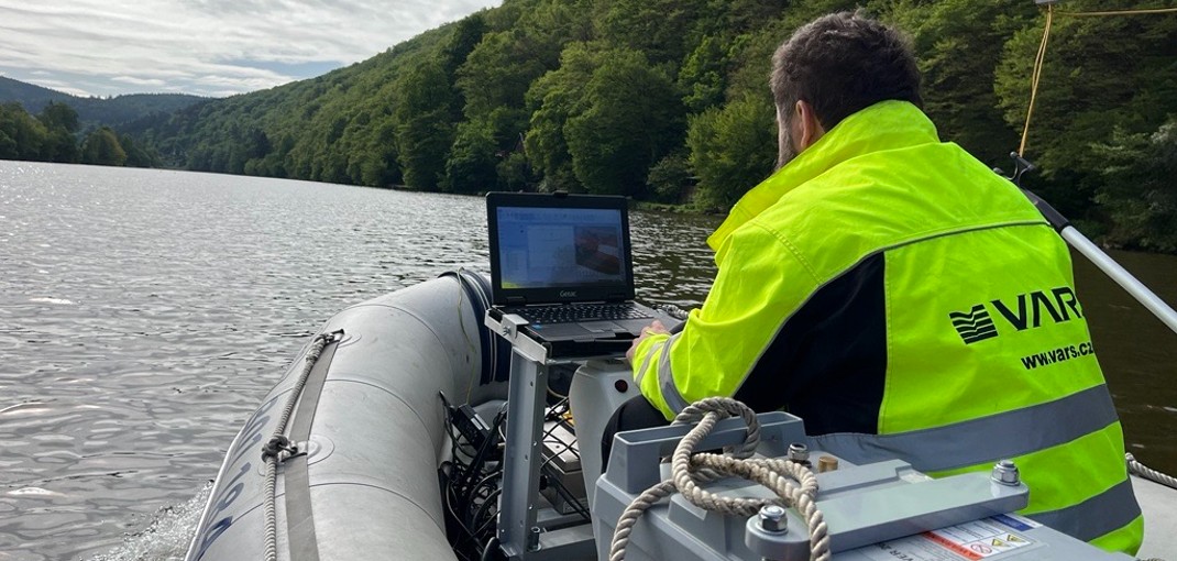
In recent weeks, the VARS BRNO team has been finding out how the mining works at the mouth of the Sázava River are progressing by using a system that was developed according to VARS BRNO’s design. It can quickly and accurately create a model of the bottom of the watercourse and monitor sediments and underwater structures.
News
04 August 2023In recent weeks, the VARS BRNO team has been finding out how the mining works at the mouth of the Sázava River are progressing by using a system that was developed according to VARS BRNO’s design. It can quickly and accurately create a model of the bottom of the watercourse and monitor sediments and underwater structures.
In this particular case, the VARS BRNO team was tasked with surveying the bottom of the Sázava River, where PAS Natura mines sediments. “During the first measurement in May, we monitored the area of interest, where mining has started and will continue. We will repeat the measurements in the following months so the client has a regular overview of the sediment extraction progress,” explains project manager Iva Klímková.
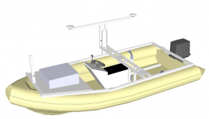
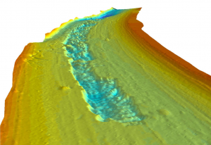
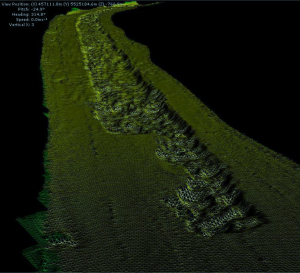
VARS BRNO used the technology developed in line with its design for the measurements. Instead of the usual scanning of transverse profiles and their interpolation into a continuous surface, it creates a continuous digital model. “This underwater measurement corresponds in accuracy and detail to conventional measurements on land,” explains VARS BRNO consultant Jiří Svoboda. The BOMBARD measurement boat is equipped with a 500 kHz multibeam GeoSwath Plus Compact sonar.
“The ship’s exact position is always monitored by a GPS unit with RTK corrections. The tilt unit (the unit managing tilt) and other sensors then correct for errors caused by the vessel’s movement and different characteristics of the water environment,” Svoboda says, adding that the measurement is not only very accurate but also fast. Before the system processes the continuous measurement itself, it compensates for the forward and lateral roll of the ship. Also, it considers the effect of the water column height on the sound propagation speed underwater.
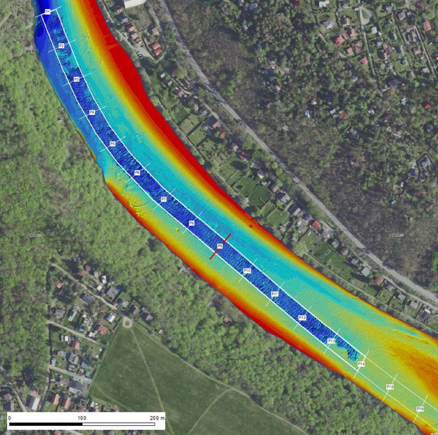
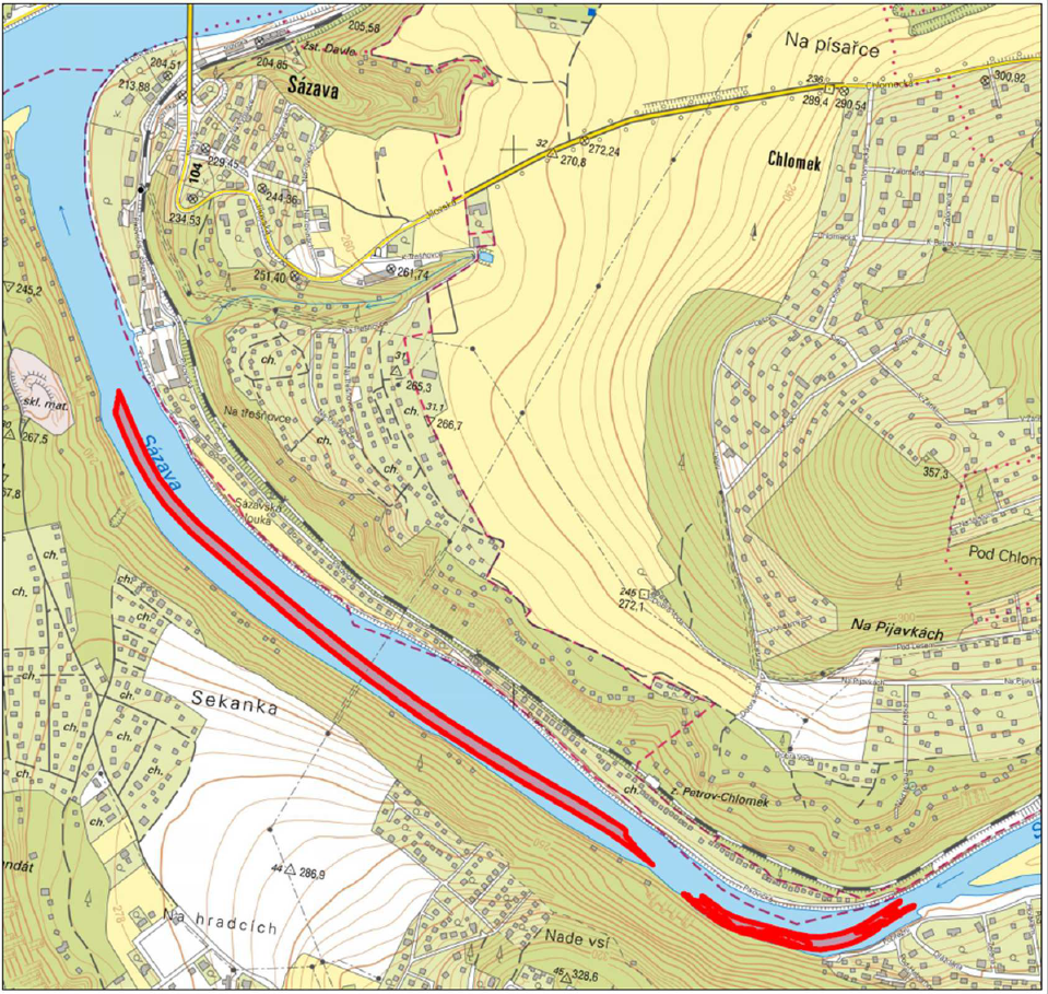
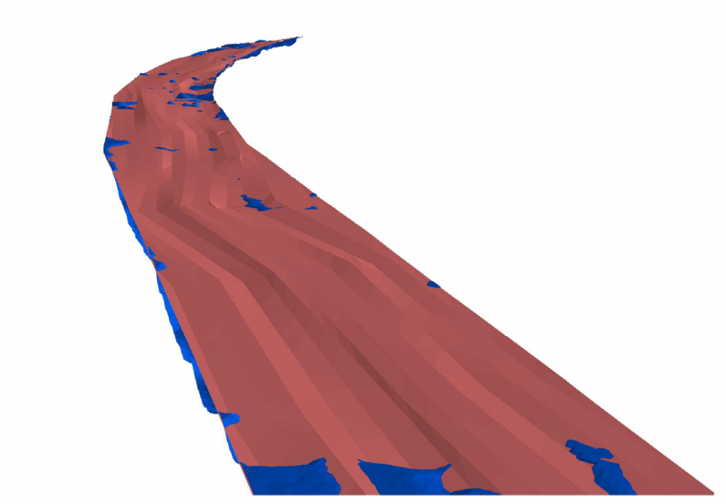
On the image from the measurement day, the land corridor designed for excavation is marked. It also shows how the work has progressed. However, the VARS BRNO team had one more task from the client–to calculate the volume of extracted sediments. “We had a reference digital model from the contractor, which was constructed traditionally based on cross-section data. In order to make the calculation as accurate as possible, we supplemented the baseline data with 3D lines connecting the individual points of the transverse profiles,” explains Jan Russnák from VARS BRNO’s GIS department. From this model, Russnák created a digital seabed model that corresponds as closely as possible to the state before mining began–this was compared with the measured data.
“By software calculation based on two models, we found a difference in the volume of 6.240 cubic metres below the initial bottom level. With a certain degree of tolerance, this can be considered as the volume removed from the river bottom,” concludes Jiří Svoboda. A comparison of the cross-sectional data with the obtained data also shows how detailed and accurate the data are compared to the traditional method. Among other things, the measurements also showed places where the volume of sediment after extraction was higher than before extraction. “This is probably due to the movement of river sediments caused by mining or their loosening,” explains Russnák of this anomaly.


NEWS